
On the coastBack roads around the lagoon are narrow and partly unpaved, with little shade. Go in the morning or evening, carry repellent, and pull fully off the road to stop.
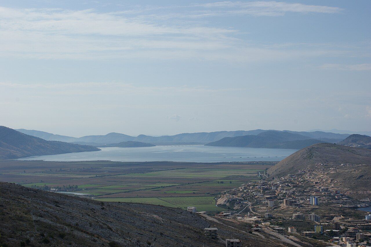
From the hill of Lëkurës above Sarandë, look south and you see a long sheet of grey-blue water lying between low hills, separated from the sea by the thin strip of land where Ksamil stands. That is Lake Butrint, a coastal lagoon rather than a true lake. It is the quiet heart of the country south of Sarandë: no beaches, no promenade, just still water, reed beds, fields and the lines of the mussel farms running out across it.
Most visitors only glimpse it from the car on the way to the ruins or the coves. It repays a slower look.
A lagoon, not a lake
Lake Butrint is brackish: part fresh, part salt. Streams and springs from the surrounding hills feed fresh water into it, while the sea comes in through the Vivari Channel, a narrow, winding passage that runs from the southern end of the lagoon past the ruins of Butrint and out into the Straits of Corfu. The mix of the two, and the sheltered, shallow edges, make the lagoon unusually rich in life.
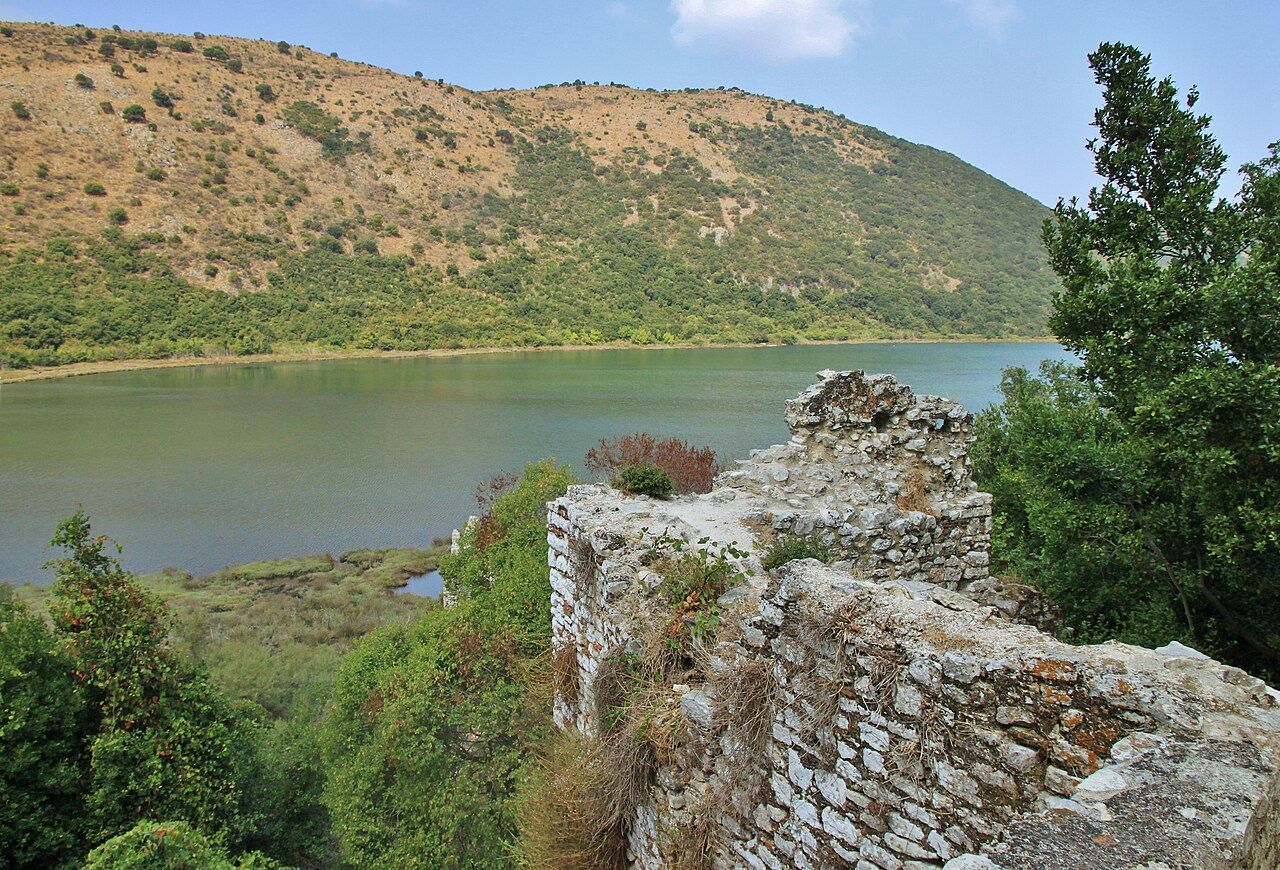
The lagoon and the land around it are part of the protected area of the Butrint national park, which takes in not just the ancient city but the wetlands, the channel and the hills that frame them. That status reflects how closely the history and the landscape are tied together: the city existed because of this water, its harbour and its fish.
The mussel and oyster farms
The most striking thing on the lagoon is man-made. Across large stretches of the water stand long rows of wooden platforms and posts, the frames of mussel and oyster farms. From the hills they look like stitching on a grey cloth; from the shore they are rough timber structures, with ropes hanging down into the water where the shellfish grow.
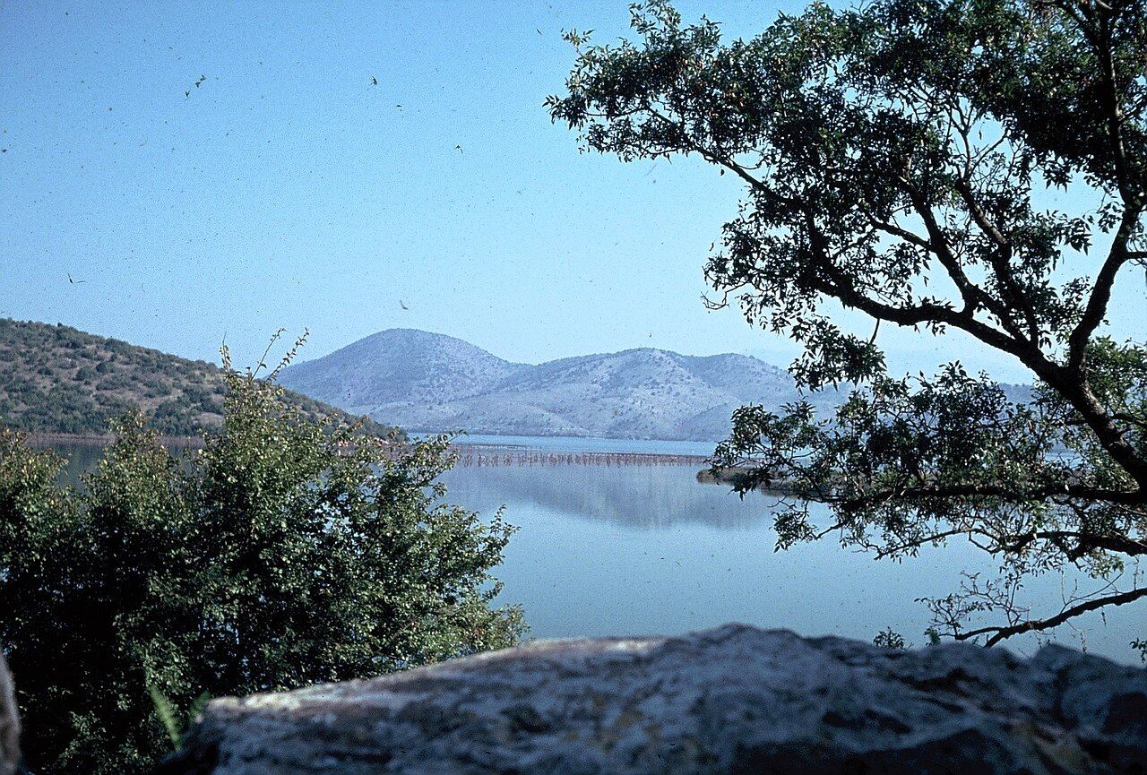
Shellfish farming here is not new. The rows of stakes were already a feature of the lagoon decades ago, and the work has continued through very different economic times. The calm, nutrient-rich water suits mussels well, and they end up in kitchens all along the coast. If you eat grilled or steamed mussels in Sarandë or Ksamil, there is a good chance they came from these platforms; our guide to food on the southern coast has more on the local dishes.
- Look, do not board. The platforms are working farms, not piers, and they are private.
- Keep clear by boat. Ropes and lines run below the surface around them.
- Morning is best. The water is often glassy early, and the rows reflect cleanly.
Birds and wetlands
Reed beds, mudflats, salt marsh and shallow channels make the lagoon edge good ground for birds. Herons and egrets stalk the shallows, cormorants dry their wings on the farm posts, and gulls and terns work the open water. In the cooler months the wetlands draw wintering waterbirds, and the numbers and species change with the season and the weather.
Onward · Butrint & KsamilKsamil and its little islandsYou do not need special access to see some of this. A pair of binoculars, a pull-off beside one of the lagoon roads, and a little patience in the early morning are usually enough. Keep your distance from nesting areas in spring, stay on tracks, and do not walk into the reed beds, which are both fragile and, in places, much wetter than they look.
The same wet ground means mosquitoes. In summer they are at their worst around dusk and after rain, so carry repellent and cover up if you plan to stay into the evening.
Quiet roads around the water
The main coast road from Sarandë to Butrint runs along the western side of the lagoon, between it and the sea, past the edge of the village of Ksamil. Smaller roads and farm tracks branch off it towards the water, and others circle the northern and eastern shores through fields, olive groves and small villages.
These back roads are the best way to see the lagoon. They are narrow, some are rough or unpaved, and they can be muddy after rain, so take them slowly. Traffic is light outside the main road, which makes them pleasant for cycling in the cooler months; in summer the heat and the lack of shade make cycling hard work after mid-morning.
- Start from the coast road just south of Sarandë and follow the lagoon side.
- Stop where the farm rows come close to shore for the clearest view.
- Carry on towards Butrint, where the lagoon narrows into the Vivari Channel.
The Vivari Channel
At its southern end the lagoon drains into the Vivari Channel, the water that once gave Butrint its harbour. The channel winds past the foot of the ancient city, with Venetian towers standing over it, and on towards the sea. A small cable ferry crosses it just beyond the site entrance, carrying cars and people towards the south and the Greek border. Running times depend on the season.
Standing beside the channel, you can see the whole system at once: lagoon behind you, open sea ahead, and on the hill above you the walls of the ancient city of Butrint, which grew rich on this exact meeting of fresh and salt water.
Months and what to pack
Spring and autumn suit the lagoon best. In April and May the fields are green and the birdlife is busy; in September and October the light is soft and the summer traffic has gone. High summer brings heat, haze and mosquitoes, though early mornings can still be lovely. There is no swimming to speak of in the lagoon itself; for that, cross to the sea side at Ksamil.
Bring binoculars, water, a hat and repellent. Allow an hour or two for a slow drive or ride around the water, more if you stop to watch birds. And for the view that shows it all, climb to Lëkurës Castle in the evening, when the sun goes down over Corfu and the lagoon turns silver below.